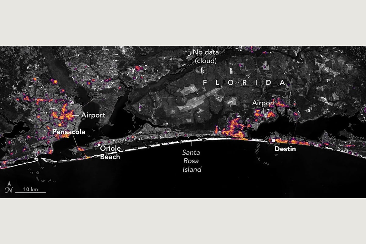
NASA’s October 16 report contrasts an August baseline with observations from October 11 and 12. Reduced lights around Pensacola and toward Destin suggest power disruptions, followed by recovery in parts of the region.
The product combines processed NOAA-20 VIIRS observations with a Landsat base map. Clouds and other environmental effects require careful treatment. NASA stresses that satellite observations complement ground outage reports; imagery alone cannot explain why particular locations retained power.
Go to the source
This is an original summary, not a republication of the full report.
Read the original at NASA Earth Observatory ↗